Maff Colorado 2024
The plan this year was divided into two weeks. The first week, I planned to spend solo in the Sangre de Cristo range in southern Colorado, with plans on the greater Crestone group (Humboldt Peak, Crestone Peak and Needle, Kit Carson Peak, and Challenger Point).
The second week, I arranged to meet up with two friends, Rand and Maya, who I’d met the year before climbing Mt. Sneffels. They were close to finishing the 14ers and had camping permits for their remaining summits in the Elk Range, near Aspen (Capitol Peak, Snowmass, and the Maroon Bells).
Saturday, August 17-Sunday August 18: driving and acclimatizing
I drove from Austin to Westcliffe, CO (815 mi; 13 hours). Westcliffe (7,871′) is located on the east flanks of the Sangre de Cristo Mountains, about an hour and a half southwest of Colorado Springs. I stayed two nights at the Westcliffe Inn to acclimatize to the elevation.

Monday, August 19: South Colony Lakes
I drove about 30 minutes to the nearby “lower” South Colony Lakes Trailhead (8,800′) and parked there, beginning my hike around 7:30 AM.

The upper trailhead was another 2.7 mi up a rough 4WD road, at 9,950′. I hiked it and did not regret it, even carrying a three-day pack.

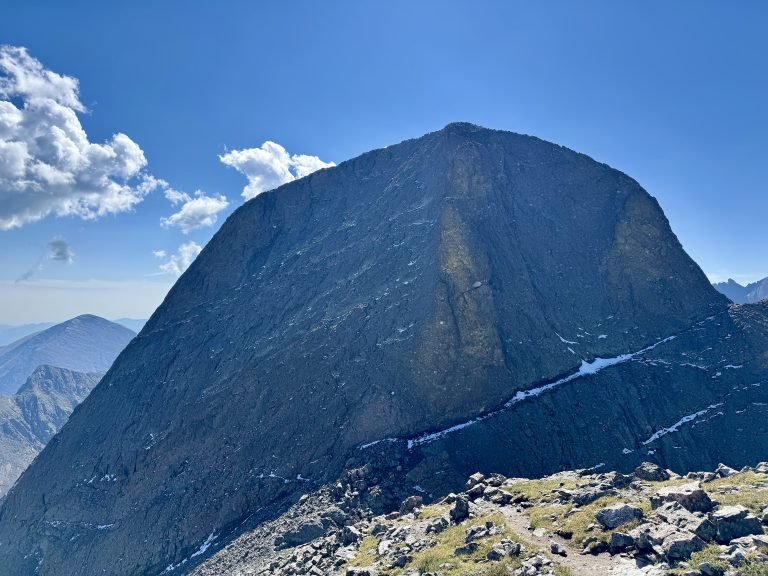
The hike into the South Colony Lakes basin was about 6.5 mi and 3,000′ gained, and took me around 4 hours, moving at a leisurely pace. You spend much of it staring directly at Crestone Needle from its most striking side.

I made camp above the lower lake, around 11,650′. I had a good view of the Needle directly from my tent door, but the tradeoff was that I had to dodge tree branches every time I entered or exited the tent.

South Colony Basin is a really beautiful and special place. While it can get crowded on weekends, I saw maybe a dozen people in the three days I was there.


After making camp, I walked down to the stream connecting the lakes to filter water for tomorrow’s hike up Humboldt Peak. Unfortunately, my Sawyer Squeeze water filter was apparently completely clogged and wouldn’t work. I had made the mistake of forgetting to backflush it after the previous trip or test it before this trip. Fortunately, I had brought the tools to backflush it (a syringe); unfortunately, those were in my car, 6.5 mi and 3,000′ away. After considerable effort, I managed to get a trickle of water through the filter, at the rate of about one liter per hour. Thankfully, another climber soon arrived at the stream and I borrowed his filter to fill the rest of my water bottles while he told me about his adventures on Humboldt and the Needle. I thanked him and finished preparing the day pack for tomorrow and went to bed around dark (8:00 PM). Nighttime temperatures in the Basin got into the high 30s. I heard a coyote pack howling on the other side of the lake.
Tuesday, August 20: Humboldt Peak
Knowing I should have a shorter day ahead of me, I slept in and started Humboldt Peak around 7AM. The long approach Monday left me with a little over 2 miles and 2,418′ feet to the summit, mostly on a good trail that crosses the stream and winds through some willows before switchbacking up a steep slope to a saddle on Humboldt’s shoulder.
While Humboldt Peak itself is a somewhat shy lump that eludes easy photos during the ascent, you are treated to some of the best views of Crestone Peak and Crestone Needle anywhere throughout the hike.

From the saddle, you turn right and ascend steeper rock ledges, through which there is sometimes and sometimes not a trail.


The high point above is a false summit; after reaching it, you cross a grassy slope to a final easy scramble to the true summit.


The summit is broad and the Crestones dominate the view.

I enjoyed Humboldt more than I expected. From a camp in South Colony Lakes, it’s a short, steep hike with great views the whole way and some fun rock-hopping below the false summit and true summit.
Garmin stats (the mileage is low due to 10 minute tracking intervals): 3.7 mi, 2,656′ gain, 4H53M tent to tent.

Back at camp, I filtered more water (slowly), repacked the daypack for tomorrow’s attempt on the Crestones, and watched the sky change colors, occasionally soundtracked by a couple camped nearby who sounded like they were in the process of breaking up.

Wednesday, August 21: Crestones Attempt
I started early, at 4:15 AM, in the dark. From the lakes, the route up to either Crestone starts with a tedious climb up Broken Hand Pass, which is steep, loose, and tricky if wet or snow/ice-covered.

It was a cold morning and it unfortunately began raining shortly after I started hiking, around 4:30 AM. I was not thrilled about the prospect of climbing Broken Hand Pass in the rain, and doing either the Peak or the Needle in the rain or with wet rock would be well beyond my comfort level. At 5:00AM, when the rain had picked up instead of subsiding, I turned around, figuring that we were in for enough rain to at least keep the rock wet through the morning climbing window. Sure enough, the rain continued for at least another two hours, well after the sun rose, which I monitored loosely while dozing in a warm, dry sleeping bag.
In the late morning, I weighed options. I had enough food for at least another day if not two, and my original plan involved staying 3 nights, climbing Humboldt Tuesday, one Crestone Wednesday, and the other Crestone Thursday, before hiking out. I could make another attempt on one or even both Crestones tomorrow if I stuck around. However, filtering water was still a slow, tedious process until I could return to my car and fix my filter.
Alternatively, I could break camp and hike out that day, resupply, fix my water filter, get a big meal and a hotel room, shower, change clothes, and relocate to the west side of the Sangre de Cristos. The Sangres is a thin range that runs north-south and I had initially considered approaching the Crestones from from Cottonwood Creek, on the west side of the range, before deciding to stick with the standard east approach so that I could tag Humboldt. The Cottonwood approach has a rough reputation, too, as being overgrown and more difficult to follow than the standard route.

One advantage to Cottonwood Creek involved Broken Hand Pass. The standard route up the Crestones (from the east, from South Colony Lakes) required you to climb Broken Hand Pass. From the Pass, you could climb directly up the Needle but for Crestone Peak, you had to descend nearly 800 feet to Cottonwood Lake and traverse past the backside of the Needle to then climb the Peak. From the top of the Peak, you could take the technical traverse across to the Needle and then descend to the Pass and back to camp. If you didn’t attempt the challenging Traverse, you would have to descend the Peak and regain the 800 feet to the Pass, from where you could climb the Needle (if your legs and the weather cooperated) or return to camp and leave the Needle (and another trip up the Pass) for the next day.
However, from Cottonwood Creek, you could camp directly at Cottonwood Lake, making for a short trip directly to the Peak. Crestone Needle from Cottonwood Lake would still require a trip up to Broken Hand Pass (unless you traversed directly to the Needle from the Peak) but the west side of Broken Hand Pass was considerably easier than climbing it from South Colony Lakes on the east. Finally, my initial plan to climb Kit Carson Peak and Challenger Point would take me to the west side of the range anyway, and that trailhead was very close to the trailhead for the alternate Crestone approach. I decided hiking out today and heading to the west side of the range sounded like a good idea, so that’s what I did.

The ~6 mi hike out went quickly (2H40M) and I drove out to Salida, on the north edge of the Sangres, had a good pizza at Moonlight Pizza, and got a small but charming room at The Lodge at Poncha Springs (just west of Salida), where I showered and repacked the backpack for a very light overnight setup (one set of clothes, no camping stove).
Thursday, August 22: driving to Crestone
The Cottonwood Creek hike to Cottonwood Lake is 6 miles and 3,000′ gain, with some light bushwhacking and scrambling required at the end, so I decided to give myself all day Friday to knock that out in the daylight and use Thursday as a travel day. I drove down the length of the range to Alamosa, where I got lunch and killed time at a bookstore. I then drove to the town of Crestone, which is an odd little commune on the western slopes of its namesake Crestone Peak and Needle.

The town of Crestone is home to a couple hundred people and “more than two dozen ashrams, monasteries, temples, retreat centers, stupas, labyrinths, and other sacred landmarks.” The Cottonwood Creek trailhead is on private property belonging to one of the religious centers, who maintain public access on the dirt road (but discourage sleeping overnight at the trailhead).

To get an early start, I slept in the back of the car to avoid having to set up and tear down the tent. I was surprised by a person walking up the road away from town after dark; he was friendly and explained that he’s a local resident who lives above the trailhead somewhere and walks down to the pub on Thursdays for open mic nights.
Friday, August 23: Cottonwood Creek and Crestone Peak
I had a great time on the Cottonwood Creek approach. It’s a long, rough hike (5-6 miles and nearly 4,000′ of gain, from 8,300′ to almost 12,000′) so I wanted an early start (in theory to avoid setting up camp in the anticipated afternoon rain), but because the trail supposedly becomes more difficult to follow towards the end, I wanted to make sure the sun would be up before that point. I started at 5:30 AM and enjoyed a quiet hike through the still woods along the creek as the sun rose around 6:30.


To pass the waterfall, you have to climb a surprisingly steep set of rocks overgrown by a thick tree root.

Past the waterfall, you encounter several sections of large, smooth rock slabs, some of which are quite steep.


I lost and picked the trail back up a few times throughout the last mile and a half, as it crossed slabs and willows. While it could have been tedious, I found it engaging. It was an adventurous approach and I was the only person on it that day.


Up the chimney, I bashed through some willows and found myself in a large clearing just below Cottonwood Lake, with the Peak and Needle hidden in the fog directly in front. I made camp here, on the other side of the large rock center. The approach had taken 4H53M, covering 4.5 mi and climbing 4,952′.

Given the gloomy skies and the long morning I’d had, I decided to retreat into the tent to read, which turned into a nap.

I was woken up by the sound of a helicopter around 2PM. I watched for a while as it made a couple low passes and then flew out of view. I would later learn from a couple camped at the lake above me that the helicopter landed next to the lake to arrange gear and personnel for a mission on Crestone Needle. “Not a happy ending,” was as much as they got from the Search and Rescue personnel. Afterwards, I found a post from Custer County SAR regarding the operation. There was enough information in the post and comments to understand that a hiker on Crestone Needle’s body was retrieved by helicopter personnel. This operation continued throughout the day as I later climbed Crestone Peak and I took several photos and videos of the operation as it happened. Given the unfortunate outcome, I don’t feel comfortable posting or sharing that footage anywhere.
In the meantime, however, I noticed that the sky looked friendly for a Colorado summer afternoon – some clouds but nothing especially ominous. I checked the forecast from my inReach, which indicated no chance of rain the rest of the day. I decided that I would at minimum scout the route up to the lake from where I was camped, since there was some more bushwhacking remaining before I met up with the standard Crestone Peak route, which I would otherwise be doing in the dark tomorrow morning. If the weather was holding, I would continue on and if it looked dicey, I would be turn around and try in the morning. As it happened, the weather held out.


The wind had picked up so I stayed at the summit of East Crestone for maybe 10 seconds before returning to the Gully.


Descending took slightly longer than ascending. My round trip was 3.2 mi, 3,783′ climbed, 4H49M.
Helicopter operations resumed on the Needle during the descent and continued until just before sunset, around 7:30PM. The flying seemed impressive given the wind and fading light.
Saturday, August 24: exiting Cottonwood
I stayed overnight at my high camp below the lake but the morning was foggy and damp.

Given the previous day’s events (7.7 mi, 8,375′ climbed, and a body retrieval next door on my target peak), I decided not to attempt the Needle solo this trip after all. I had a big week still ahead of me that I wanted to rest up for, too.


After a 3 hour hike back to the car, I drove to Guffey, CO (a small town south of Breckenridge) where my friends Randall and Maya have a cabin and a guestroom in their barn.

Maya and Rand had just returned from a summit of Little Bear that day, their 54th 14er, leaving only the peaks on our itinerary for the week: Capitol, Snowmass, Maroon, and North Maroon, all in the Elk Range, all requiring permits for camping (which Rand and Maya had). We showered, changed, got dinner in town (live music at the one bar in town), and went to bed early.
Sunday, August 25: rest day with Rand and Maya
Because of the camping permits, we couldn’t get started climbing until Monday, so we spent the day relaxing. First, though, we hiked the hill behind Rand and Maya’s cabin to their small climbing crag, where we practiced top-roping and belaying.


Monday, August 26: Capitol Lake Approach
We drove about 3 hours, over Independence Pass, through Aspen, to the Capitol Creek Trailhead.


Tuesday, August 27: Capitol Peak
We hit the trail in the morning at 5:45 AM. Sunrise was around 6:30 and we hoped to finish the short hiking portion of the day (a 900′ hike to the Daly-Capitol saddle) around sunrise. Capitol is generally considered the hardest 14er by its standard route, so while we wanted an early start, we also didn’t want to do any technical climbing in the dark.


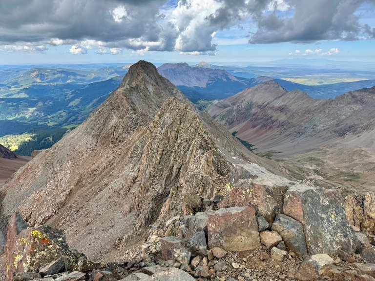
When you reach K2, you have a dramatic view of the rest of the route to the summit. If the weather is iffy here, you should strongly consider bailing, because once you proceed further you must return the way you came. There is no shortcut off the ridge. We arrived at 9AM, a little over 3 hours in, and we appeared to have a perfect day in front of us.


Wednesday, August 28: Capitol Creek to Geneva Lake
Our next reservation was at Geneva Lake, below Snowmass. Even though Snowmass was quite close to Capitol, the trailhead was a few hours’ drive away. So we left relatively early in the morning, around 8:30AM.

The road to the Geneva Lake Trailhead took us up an incredibly rough road through the old mining town of Crystal. To minimize complications, we parked my car at a nearby trailhead on public land and took Rand and Maya’s Subaru, which put in heroic work to get us to within 2 mi of the trailhead, at a parking area on public land (past the private property with prominent NO PARKING signs around Crystal) below the rough final stretch of road.


Thursday, August 29: Snowmass S-Ridge


Because of my foot issues, I decided that I should not accompany Maya and Rand on the Maroon Bells the following day. Doing both peaks would be a big day with some significant downclimbing moves required and I didn’t want to risk being too slow to keep up or doing more serious damage to my feet.


Final Stats:
- 54 miles hiked (per Garmin which undercounts mileage);
- 31,835′ elevation climbed;
- 2500 miles driven;
- 4 14ers climbed (plus East Crestone), bringing the total to 21/58.